


Precinct No. 1049, Washoe County, Nevada
About
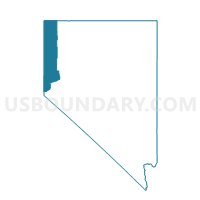
Outline

Summary
| Unique Area Identifier | 615751 |
| Name | Precinct No. 1049 |
| County | Washoe County |
| State | Nevada |
| Area (square miles) | 0.14 |
| Land Area (square miles) | 0.13 |
| Water Area (square miles) | 0.02 |
| % of Land Area | 87.93 |
| % of Water Area | 12.07 |
| Latitude of the Internal Point | 39.50411760 |
| Longtitude of the Internal Point | -119.89620760 |
Maps


Graphs
Select a template below for downloading or customizing gragh for Precinct No. 1049, Washoe County, Nevada


Neighbors
Neighoring Voting District (by Name) Neighboring Voting District on the Map
- Precinct No. 1046, Washoe County, NV
- Precinct No. 1047, Washoe County, NV
- Precinct No. 1048, Washoe County, NV
- Precinct No. 1050, Washoe County, NV
- Precinct No. 1051, Washoe County, NV
- Precinct No. 1053, Washoe County, NV
- Precinct No. 8101, Washoe County, NV
- Precinct No. 8119, Washoe County, NV
- Precinct No. 8500, Washoe County, NV
- Precinct No. 8501, Washoe County, NV
- Precinct No. 8503, Washoe County, NV
- Precinct No. 9115, Washoe County, NV
- Precinct No. 9122, Washoe County, NV
- Precinct No. 9504, Washoe County, NV
- Precinct No. 9506, Washoe County, NV